Save 80% on review costs with our new product Lattize AI — Human-centered. Transparent. Scalable. Consistent. Unbiased
Precise Orbit Determination
Precise Orbit Determination (POD) using GPS measurements has historically been the backbone of Earth observation missions in low Earth orbit (LEO), offering the stringent positioning accuracy these sensitive operations require. In our publications, we share insights into the missions we've been part of, showcasing the critical role of GPS-based POD in fulfilling their scientific objectives.
As the number of satellites in LEO has surged in recent years, traditional, less frequent methods of tracking, such as radar, laser, or Doppler systems, have become unsustainable for the crowded space. This shift has cemented the role of GPS and its broader family, GNSS, as essential for providing global and continuous tracking necessary for space safety and collision avoidance.
For operators of LEO mega-satellite constellations, embedding a GNSS navigation payload on each satellite emerges as a cost-effective and reliable strategy to protect their space assets. A recent publication that describes the intricacies of navigating OneWeb's LEO satellite constellation was published in the Journal for Space Safety Engineering. Yoke and her co-authors share their experience managing a LEO mega constellation from a flight dynamics operations perspective. Even for missions with lower accuracy requirement, space-borne GNSS receivers are becoming increasingly important as mega-constellations populate low Earth orbit and space becomes more congested. These on-board GNSS systems, working hand-in-hand with ground-based orbit determination, are the essential elements for guaranteeing safe and sustainable navigation in the years to come.
Satellite mission: Jason-1
Mission Objective: Monitoring global sea-level changes, contributing vital data for climate research. Its mission hinged on the precision and accuracy of its orbit information, which directly bolstered the reliability of its measurements of ocean surface topography, informing our understanding of climate patterns and sea-level dynamics
Operational Altitude: ~1300km
Our Contributions: Investigated the significance of single LEO satellite GPS phase ambiguity resolution technique to further improve on the Jason-1 satellite trajectory knowledge.
Publication: The Effects of GPS Carrier Phase Ambiguity Resolution on Jason-1
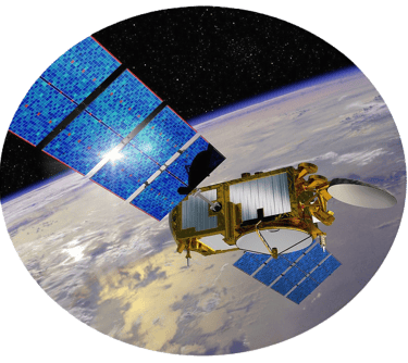

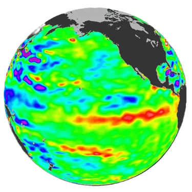

Image credit: NASA
Satellite Mission: GRACE-A/B
Mission Objective: Measures variations of the Earth's gravity field by tracking the range and range-rate between Grace-A and -B satellites.
Operational Altitude: ~500km
Our Contributions: Leveraged the GRACE mission as a testbed to design a precise orbit determination (POD) workflow, mimicking the entire process from telemetry data reception to final orbit product generation and delivery. The strategy led to a robust and resilient POD system for the TerraSAR-X mission.
In a separate joint study, a new and improved near-real time GPS clock correction product was tested and analyzed for the first time on the GRACE data set.
Publication: GPS Clock Correction Estimation for Near Real Time Orbit Determination Applications


Image credit: DLR
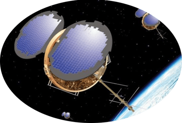
Satellite Mission: CHAMP
Mission Objectives: Maps Earth’s global long to medium wavelength gravity field and temporal variations, global magnetic field and temporal variations, and atmosphere/ionosphere sounding.
Operational Altitude: ~450km
Our Contributions: Leveraged CHAMP GPS BlackJack receiver data to assess the anticipated performance of it's no-heritage successor, IGOR, on the TerraSAR-X mission. The approach allowed a realistic prediction of the IGOR GPS receiver baseline performance in meeting TerraSAR-X orbit requirements.
Publication: Precise Orbit Determination For The TerraSAR-X Mission
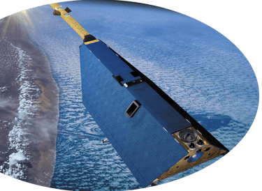

Image credit: GFZ
Satellite Mission: TerraSAR-X
Mission Objective: Make multi-mode and high-resolution X-band data available for a wide spectrum of scientific applications. Acquire 2D SAR observations in the operational modes Stripmap, ScanSAR and Spotlight.
Operational Altitude: 514km
Our Contributions: Architected, developed, validated and maintained the end-to-end automated POD process (pre-launch); Assessed performance of the IGOR GPS receiver in meeting Synthetic Aperture Radar (SAR) application requirements (post-launch).
Publication: TerraSAR-X Precise Trajectory Estimation and Quality Assessment
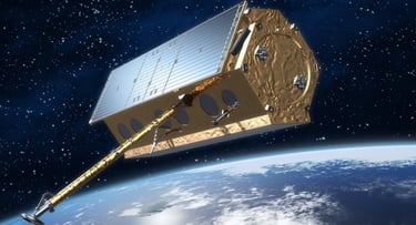

Image credit: ESA
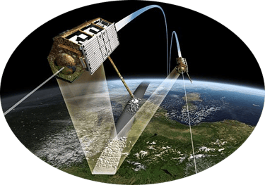

Satellite Mission: TanDEM-X
Mission Objectives: Generates highly accurate 3D global digital elevation model (DEM) when flying in tandem formation with TerraSAR-X, along-track interferometry, and bistatic applications
Operational Altitude: 514km
Our Contributions: Used GRACE-A/B close approach GPS data to demonstrate the high precision satellite-to-satellite baseline determination concept, expected accuracy and quality control strategies.
Publication: GPS-based Precision Baseline Reconstruction for the TanDEM-X SAR Formation
Image credit: DLR
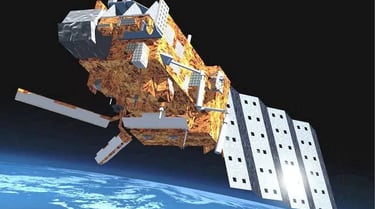
Satellite Mission: MetOp-A
Mission Objective: Operational climate monitoring from low Earth orbit, improving global weather prediction and understanding of climate change. In addition, it has substantial contribution to environmental monitoring such as sea surface temperatures, wind speeds, and soil moisture.
Operational Altitude: ~817 km
Our Contributions: Analyzed and developed the radio occultation (RO) data re-processing strategy for the ERA-CLIM project, investigated the impact of GPS clock products on POD. The work ensures high quality bending angle profiles for improved weather prediction and climate modeling.
Publications: Impact of Satellite Orbit and Clock Quality on GPS Radio Occultation Data Processing;

Satellite Mission: COSMIC-1 Constellation
Mission Objectives: Provide detailed atmospheric data using radio occultation techniques by measuring the bending angle of the GNSS signals as they travel through the atmosphere. It has significant contribution to climate monitoring, ionospheric research, and operational weather forecasting.
Operational Altitude: ~800 km
Our Contributions: Upgraded the COSMIC Data Analysis and Archive Center's (CDAAC) post- and reprocessing strategy in generating LEO satellite orbit products for GPS RO retrieval
Publication: UCAR COSMIC program support and contribution to the IGS real-time service; Quantifying the degree of distortion in the radio occultation excess phase due to inconsistency in GNSS measurement time
Image credit: UCAR
